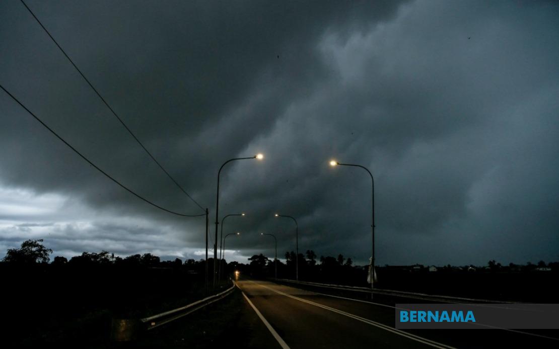
The Malaysian Meteorological Department has issued a thunderstorm warning spanning a significant portion of the country, covering nine states, the federal territories of Kuala Lumpur and Putrajaya until 6 pm. The alert indicates that residents across multiple regions should prepare for potentially dangerous weather conditions characterised by severe thunderstorms, substantial rainfall and powerful gusty winds during the afternoon and early evening hours.
In Peninsular Malaysia, the affected areas encompass a broad geographical spread. Johor has been placed under alert, along with Negeri Sembilan and substantial portions of Perak, including the districts of Hulu Perak, Kuala Kangsar, Kinta, Kampar, Hilir Perak, Batang Padang and Muallim. The warning extends through the east coast states of Kelantan and Terengganu, where vulnerable districts include Tumpat, Pasir Mas, Jeli, Tanah Merah, Kuala Krai and Gua Musang in Kelantan, as well as Setiu, Kuala Nerus, Kuala Terengganu, Marang, Dungun and Kemaman in Terengganu.
Pahang faces exposure across multiple districts stretching from the highlands to the coastal regions. The meteorological alert covers Tanah Tinggi Cameron, Bentong, Temerloh, Kuantan, Bera, Pekan and Rompin, indicating that residents from the interior regions through to the east coast must exercise caution. In Selangor, which surrounds Malaysia's economic heartland, the warning applies to Sabak Bernam, Kuala Selangor, Hulu Selangor, Gombak, Petaling, Hulu Langat and Sepang, meaning that even metropolitan areas adjacent to Kuala Lumpur face potential disruptions.
The federal territories themselves, encompassing Kuala Lumpur and Putrajaya, are directly under the thunderstorm warning. These areas serve as the administrative and commercial hub of Malaysia, suggesting that afternoon commuters, office workers and residents throughout the capital region should remain vigilant for rapidly deteriorating weather conditions. The timing through 6 pm captures the critical evening rush hour period, potentially affecting transportation networks and daily activities.
Beyond Peninsular Malaysia, East Malaysian territories also feature in the alert. In Sarawak, warnings apply to major population centres and districts including Kuching, Sarikei, Sibu, Mukah, Kapit, Bintulu, Miri and Limbang, indicating that the state's diverse geographical regions from coastal areas to interior divisions require preparedness. This extensive coverage across Sarawak reflects the widespread nature of the atmospheric disturbance affecting the broader region.
Sabah equally faces exposure across multiple geographical zones. The Pedalaman division encompassing Sipitang, Tenom, Beaufort, Nabawan, Keningau and Tambunan faces thunderstorm risk, alongside the West Coast district covering Papar, Penampang, Kota Kinabalu, Tuaran and Ranau. The Sandakan division, comprising Tongod, Telupid, Beluran and Sandakan, also remains under warning. This distribution across Sabah's interior and coastal regions demonstrates the comprehensive nature of the meteorological alert.
Thunderstorms accompanied by heavy precipitation and strong winds present multifaceted hazards to Malaysian communities. Flash flooding constitutes a primary concern, particularly in low-lying areas and districts with inadequate drainage infrastructure. Strong winds pose dangers to trees, temporary structures and overhead installations, potentially causing disruptions to power supply and transportation. The combination of these factors demands heightened awareness from residents, motorists and business operators throughout the affected regions.
Authorities recommend that residents remain indoors during the peak of thunderstorm activity where practical. Motorists should exercise additional caution and reduce speeds on roads, particularly in areas experiencing heavy rainfall where visibility becomes compromised. Boaters and water users should refrain from venturing into waterways during the warning period, as water levels can rise rapidly and currents strengthen dramatically during intense rainfall events. Outdoor activities and construction work should be postponed until conditions improve.
The geographical breadth of this alert underscores the scale of atmospheric instability affecting Malaysia on this particular day. The concentration of warnings across the peninsula's east coast and select peninsula and Sabah interior areas suggests a particular weather pattern or convergence zone responsible for the thunderstorm development. Residents should monitor updates from the Malaysian Meteorological Department for any extensions or modifications to the warning period, as conditions may intensify or persist beyond the initially predicted timeframe.
For businesses and essential services, contingency planning becomes prudent during such alerts. Organisations should ensure backup power supplies remain operational, secure outdoor equipment and reinforce communications systems to maintain operational continuity should disruptions occur. Schools and public facilities in affected areas may need to adjust schedules or increase supervision to ensure public safety during the warning period.
The combination of this afternoon's thunderstorm activity across such extensive territory highlights Malaysia's susceptibility to severe weather phenomena during certain seasonal patterns. Climate considerations and monsoon transitions continue to produce meteorological conditions that necessitate regular public alerts and preparedness measures. Citizens throughout the affected regions should treat this warning seriously and take appropriate precautions to protect life and property until atmospheric conditions stabilise and the meteorological department lifts the alert.