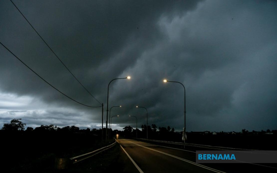
Malaysia faces widespread severe weather conditions today as the Malaysian Meteorological Department (MetMalaysia) has issued thunderstorm and heavy rain alerts affecting numerous states and federal territories from now through 5 pm. The advisory encompasses large swaths of Peninsular Malaysia alongside significant portions of Sabah, Sarawak and Labuan, with meteorologists warning of accompanying strong winds that could pose additional hazards to residents and commuters.
In Peninsular Malaysia, the northern states face particular vulnerability, with Perlis and Kedah placed under alert status. Within Kedah, the forecasted impacts will concentrate on several districts including Langkawi, Kubang Pasu, Kota Setar, Pokok Sena and Padang Terap, areas that frequently experience intense monsoonal activity during certain periods. Similarly, Perak's coastal and central zones—specifically Manjung, Perak Tengah and Hilir Perak—are anticipated to encounter severe weather, reflecting the region's exposure to moisture-laden weather systems.
The central corridor of Peninsular Malaysia, spanning federal territories and surrounding states, remains significantly at risk. Kuala Lumpur and Putrajaya, alongside Melaka, have all been flagged for potential thunderstorm activity. Selangor, which encompasses the Greater Klang Valley and surrounding regions, faces particularly broad coverage under the warning, with eight districts specifically identified: Kuala Selangor, Hulu Selangor, Klang, Gombak, Petaling, Kuala Langat, Hulu Langat and Sepang. This extensive alert across Selangor underscores the unpredictable nature of convective systems affecting Malaysia's most densely populated region.
The southern peninsula states also feature prominently in today's weather advisory. Negeri Sembilan's six identified districts—Jelebu, Seremban, Port Dickson, Kuala Pilah, Rembau and Tampin—will experience the forecast conditions, potentially affecting key transportation corridors and economic hubs in the state. Johor's southern districts of Tangkak, Segamat and Muar have similarly been designated as vulnerable areas, a pattern consistent with how thunderstorm systems develop across Malaysia's southern reaches during particular atmospheric conditions.
Beyond Peninsular Malaysia, Sarawak faces considerable exposure to the forecasted severe weather system. Kuching, the state capital and primary commercial hub, remains under alert status alongside Samarahan, its satellite municipality. The coastal districts of Mukah will see impacts concentrated in Matu, Dalat and Mukah town itself, while Kapit's Song area and Miri's northern zones—including Subis, Telang Usan and Miri proper—have been identified as regions expecting thunderstorms and heavy precipitation. These warnings reflect how maritime weather systems regularly influence Sarawak's diverse geography.
Sabah's eastern territories have also been incorporated into MetMalaysia's alert framework. The Interior region, specifically Kuala Penyu, and the southeastern district of Tawau, including Tawau town and Semporna, face the forecasted severe conditions. These areas, situated along Sabah's coastal and interior margins, frequently encounter dramatic weather shifts driven by moisture convergence and orographic uplift across the state's varied terrain.
The issuance of this comprehensive weather alert carries several practical implications for residents, businesses and transportation operators across Malaysia. Heavy rainfall could trigger localized flooding in low-lying areas, particularly within urban zones where drainage systems face periodic capacity challenges during intense precipitation events. Strong winds accompanying the thunderstorms pose risks to poorly secured structures, outdoor installations and elevated infrastructure, demanding heightened vigilance from property owners and facility managers.
Commuters and transportation operators should exercise enhanced caution during the warning period. Reduced visibility caused by heavy rain combined with strong gusty winds can significantly compromise road safety, particularly on highways and elevated routes. The timing of this weather system—lasting until 5 pm—coincides with portions of the business day and early evening commute periods, potentially disrupting traffic flows and transport schedules across affected regions.
For businesses and households in designated alert areas, MetMalaysia's advisory effectively recommends preparatory measures including securing loose items, inspecting drainage systems and ensuring weather-resistant sealing of structures. Residents in flood-prone localities should maintain awareness of evacuation procedures and local authority advisories, as isolated intense rainfall can occasionally overwhelm drainage infrastructure despite warnings and preparations.
The broad geographic scope of today's alert reflects the interactive meteorological conditions currently influencing Malaysia's weather patterns. Such widespread convective activity typically emerges when atmospheric instability combines with moisture availability and appropriate wind shear, creating conditions favorable for thunderstorm development across expansive territorial areas rather than isolated locales.
Residents and business operators are advised to monitor MetMalaysia's updates throughout the day, as severe weather alerts can be modified or extended based on evolving atmospheric conditions. The department maintains active monitoring systems and issues revised advisories when circumstances warrant, ensuring the public receives current information regarding developing weather threats.
The five-hour duration window provided—through 5 pm—represents MetMalaysia's confidence interval for the forecast system's activity period. Weather systems of this classification typically exhibit temporal variability, with conditions potentially moderating or intensifying within the alert window depending on atmospheric evolution and other meteorological factors influencing Malaysia's regional climate systems.