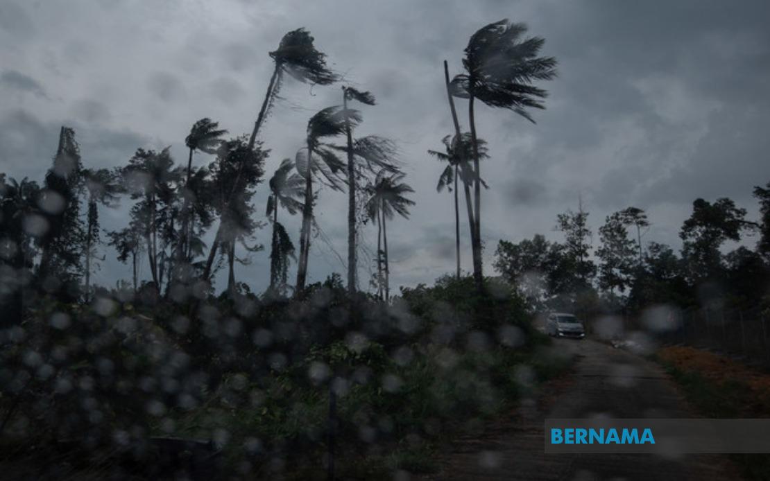
The Malaysian Meteorological Department issued a weather warning at 8:35am on Friday covering multiple regions across Peninsular Malaysia and Sarawak, cautioning residents of thunderstorms, heavy rainfall and gusty winds expected to persist through the early afternoon. The alert underscores the unpredictable nature of Malaysia's tropical climate during the northeast monsoon transitional period, when atmospheric conditions frequently produce sudden and intense convective systems.
In Peninsular Malaysia, the alert encompasses all of Perlis and Melaka, making these the two states facing the broadest coverage under the warning. Additionally, three districts in Kedah have been flagged: Langkawi, Kubang Pasu and Kota Setar, reflecting the meteorological department's assessment that these northern localities are positioned within the storm system's trajectory. Perlis and Melaka's blanket coverage suggests particularly severe conditions may develop across these entire states, prompting authorities to advise heightened caution among residents and motorists.
The central belt of the Peninsula is similarly affected, with three areas in Pahang listed for concern: Kuantan, Pekan and Jerantut. These locations, spanning both coastal and inland regions of the state, indicate the weather system's extensive reach. In Selangor, Sepang and Kuala Langat face the warning, with Sepang's inclusion particularly significant given its proximity to Kuala Lumpur International Airport and major transportation corridors. The alert also encompasses five districts across Negeri Sembilan—Port Dickson, Seremban, Rembau, Kuala Pilah and Tampin—reflecting near-statewide exposure to severe weather potential.
Johor's southern districts of Tangkak and Muar have been included in the alert, suggesting the storm system's influence extends into the country's southernmost peninsula region. This geographic spread from the northernmost Perlis to southern Johor demonstrates the substantial scale of the weather disturbance, potentially affecting millions of residents across multiple economic zones and population centres. The inclusion of Port Dickson, a major coastal town and recreational destination, underscores the need for maritime safety precautions during the warning period.
Across the South China Sea in Sarawak, nine areas have been designated as falling within the alert zone: Mukah, Selangau, Sibu, Sarikei, Maradong, Bintulu, Kapit, Bukit Mabong and Subis in Miri. These localities span both coastal and inland regions of the state, suggesting a broad-based weather system affecting Sarawak's diverse geography. The inclusion of Sibu, the state's second-largest city, indicates that significant population centres and commercial hubs are within the impact zone, necessitating preparedness measures for potential disruptions to daily activities and transport networks.
MetMalaysia has classified this as a short-term weather alert, meaning it remains valid for no longer than six hours from the time of issuance. Given the 8:35am release time and the stated expiration at 1pm, residents and authorities have approximately four and a half hours to take appropriate precautions. This brief timeframe is characteristic of tropical thunderstorm warnings in Malaysia, where atmospheric instability can escalate rapidly but typically dissipate within a confined period. The classification reflects the meteorological department's confidence in predicting the storm system's movement and duration.
The warning specifically highlights three weather phenomena residents should prepare for: thunderstorms, heavy precipitation and strong winds. Thunderstorms pose risks of lightning strikes and electrical hazards, making outdoor activities particularly dangerous during the alert period. Heavy rain can lead to flash flooding in low-lying areas, inadequate drainage zones and near watercourses, while gusty winds may topple unsecured structures, down tree branches and impact vehicle stability, especially for high-sided vehicles travelling on exposed highways.
For Malaysian motorists navigating affected regions, the alert serves as a critical safety notice. Reduced visibility from heavy downpours combined with strong winds creates hazardous driving conditions, particularly on major expressways such as the North-South Expressway and key federal roads connecting these states. Travellers should consider postponing non-essential journeys or exercising extreme caution, reducing speed and maintaining greater following distances from other vehicles. Commercial drivers and public transport operators should review their route plans and consider schedule adjustments if necessary.
The timing of this alert during the transition between monsoon seasons is not unusual for Malaysia's weather patterns. The northeast monsoon season, which dominates from November through March, often produces outlying thunderstorm systems during its early establishment phase in August and September. These transitional periods can generate particularly vigorous convective activity as competing air masses interact across the region. The affected areas represent locations where surface heating and atmospheric instability have combined to create conducive conditions for explosive thunderstorm development.
Residents in the alert zones should take practical steps to prepare, including securing loose outdoor items, avoiding open water bodies and outdoor structures during the warning period, and ensuring adequate drainage around homes. Businesses, schools and institutions in affected areas should consider whether operations need modification during the critical hours. Fishermen and maritime operators should exercise particular caution, as strong winds and rough seas often accompany severe thunderstorms in tropical regions.
The meteorological department's decision to issue region-specific alerts rather than a blanket national warning reflects increasingly sophisticated forecast modelling capabilities. By identifying precisely which areas face immediate risk, MetMalaysia enables more targeted and effective public responses, avoiding unnecessary alarm in regions outside the storm system's path. However, residents in nearby areas not specifically mentioned should remain alert, as weather systems can shift unexpectedly or expand beyond initial projections.
Following the 1pm expiration of this alert, conditions in the affected areas may gradually improve as the thunderstorm system moves away. However, the ground may remain saturated and visibility temporarily reduced even after precipitation ceases. The meteorological department typically issues fresh updates as conditions evolve, so residents should monitor official MetMalaysia communications and established weather information channels throughout the day. This alert exemplifies the importance of maintaining weather awareness during Malaysia's dynamic tropical climate periods.