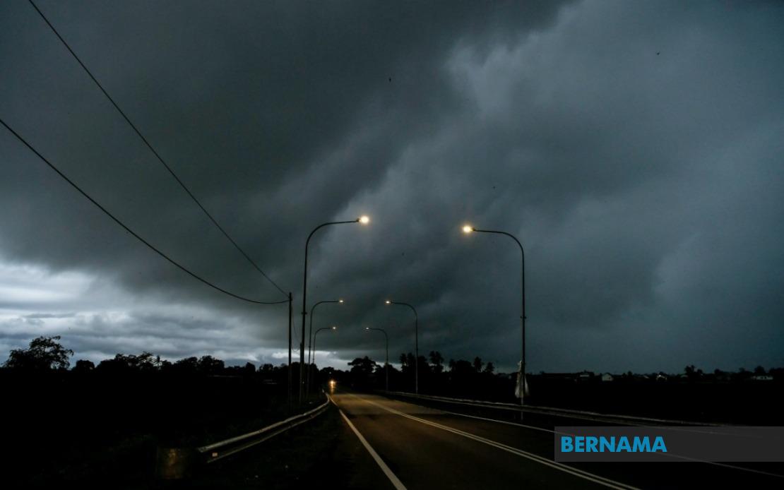
The Malaysian Meteorological Department issued an urgent weather advisory on June 18 alerting residents across multiple regions to prepare for severe thunderstorms, torrential downpours and dangerous wind gusts continuing through the early hours of tomorrow. The alert underscores the unpredictable nature of Malaysia's monsoon transition periods, when atmospheric instability frequently spawns sudden convective systems capable of causing significant disruption to daily life and economic activity.
The warning encompasses specific districts across six states plus the federal territory of Labuan. In Peninsular Malaysia, Kedah faces threats to the districts of Padang Terap, Sik and Baling, while Perak's Hulu Perak division is similarly affected. Kelantan residents in Tumpat, Pasir Mas, Jeli, Tanah Merah and Kuala Krai should remain vigilant, and Pahang's Jerantut district has also been placed on alert. These northern and east coast regions frequently experience such weather phenomena during transitional monsoon periods, though the specific targeting of particular districts suggests the meteorological department has identified concentrated areas of atmospheric instability.
Sarawak, Malaysia's largest state, faces the most extensive coverage under this warning. Thirteen distinct zones have been identified as vulnerable, spanning from the capital Kuching through industrial and agricultural heartlands. The affected areas include Kuching, Serian, Samarahan and Sri Aman in the southwest, extending to Betong's Pusa and Betong divisions further inland. The central and coastal regions of Sarikei's Julau area, Sibu's Kanowit and Selangau districts, Kapit's urban centre and Bukit Mabong, plus Bintulu face similar conditions. Northern coastal zones including Miri's Subis, Beluru, Miri proper and Marudi, alongside Limbang, complete the state's warning perimeter.
Sabah's vulnerability centres on three geographically distinct regions. The Interior division's Kuala Penyu, the West Coast's Putatan and Ranau, and Sandakan's eastern districts of Telupid and Beluran have all been flagged by meteorological authorities. Additionally, Labuan, the offshore federal territory and home to Malaysia's principal international financial centre, falls within the warning zone. This distribution reflects the monsoon system's capacity to affect both peninsular and East Malaysian territories simultaneously.
Thunderstorms of this magnitude present multifaceted risks to communities and infrastructure. Beyond the immediate danger of lightning strikes, which pose serious hazards to people and electrical systems, heavy precipitation raises flooding concerns particularly in low-lying urban areas and agricultural zones dependent on precise water management. Strong winds accompanying such systems can damage structures, fell trees and disrupt power distribution networks, potentially leaving thousands without electricity during a period of heightened atmospheric volatility.
The timing of this warning—extending until 1 am the following morning—suggests meteorologists anticipate the convective system will gradually weaken as nocturnal heating diminishes and atmospheric conditions stabilise. However, the specific retention of the alert through early morning hours indicates confidence that conditions will remain hazardous throughout the evening and overnight period. Residents and authorities should maintain heightened preparedness throughout this window.
For Malaysian businesses and public services, such alerts carry significant operational implications. Transportation networks, particularly in affected states' rural and remote areas, may experience disruption. Agricultural operations across Kelantan, Pahang and Sarawak's interior regions should secure equipment and livestock. Financial markets and trading operations in Labuan require contingency planning for potential infrastructure disruptions. Schools, healthcare facilities and emergency services across these zones must activate their severe weather protocols.
The regional concentration of warnings across East Malaysia and northern Peninsular Malaysia reflects broader atmospheric patterns characteristic of Malaysia's transitional monsoon periods. These zones frequently experience enhanced instability as competing air masses collide, creating conditions favourable for rapid convective cloud development. Understanding these patterns helps communities anticipate and prepare for such events.
Residents in warned areas should monitor MetMalaysia's updates closely, as conditions may intensify, shift geographically or ease more rapidly than initially forecast. The department's granular approach—naming specific districts rather than entire states—enables more precise planning and targeted resource deployment. Community alert systems, particularly in vulnerable areas prone to rapid flash flooding or landslides, should remain active and operational throughout the warning period.
As Malaysia continues developing its disaster management and early warning infrastructure, meteorological precision remains crucial for minimising casualties and economic losses. Public familiarity with such alerts and clear understanding of appropriate protective actions significantly improves resilience outcomes. The next 24 hours will test both the accuracy of MetMalaysia's forecast and communities' preparedness to respond effectively to severe weather.